Click for more.
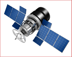
The California Air Resources Board (CARB) today announced that the state is moving forward with an innovative effort to reduce planet-warming methane emissions using satellite technology. The project is made possible by a $100 million state budget investment to purchase methane plume data collected by satellites. Methane is a climate pollutant that warms the atmosphere at least 25 times more than carbon dioxide. (Read AutoInformed.com on: CARB and United Nations Start Satellites for Climate Action)
“Decades of progress to protect public health is on the line with these EPA rollbacks. California isn’t having it. Thanks to our state investment, we’re using satellite technology to detect methane leaks as they happen. With this new data, we’ll be able to move faster to cut harmful methane pollution – protecting Californians and the clean air we’ve fought so hard for,” said Governor Gavin Newsom.
The technology involves satellite-mounted methane sensors which send data to enable the state to locate and monitor large emissions of methane that could otherwise go undetected. This data will allow state and local agencies to work together with industry to stop the leaks and protect public health.
How It Works
The satellite project and the data acquired by it is made possible by a $100 million investment from the state’s Cap-and-Trade program that Republicans in the pocket of the oil industry so hate.
The state will maintain a database and web portal to coordinate and document mitigation actions. While California does not own these satellites, state agencies will be able to select specific regions for observation. This data will also be available to communities to view methane mitigation efforts, education, and for outreach.
Methane Emissions
Methane is a clear, odorless gas released from landfills, oil and gas operations, livestock facilities, as well as natural sources such as wetlands. It is a major climate pollutant that warms the atmosphere at least 25 times more than carbon dioxide, the most common climate pollutant. Methane emissions are responsible for about a quarter of global climate pollution. Controlling methane leaks helps speed up the state’s climate protection efforts. Other harmful air pollution can also be part of methane leaks that could present risks to public health.
From 2016 to 2018, CARB worked with the Jet Propulsion Laboratory and the California Energy Commission to test plume tracking technology mounted on conventional aircraft. The survey found that less than 1% of infrastructure in the state was responsible for up to 46% of total methane emissions in California.
Conventional aircraft yield only a snapshot of what’s happening at a specific time. A satellite can survey a much wider area and because of its constant orbit can provide more detailed and continuous information to help determine the size of a leak, its duration and the volume of gas released into the atmosphere. The data can also be used to help gather details on other climate indicators such as geology and soils, agriculture, forests and vegetation, water remote sensing, urban land cover, man-made surfaces as well as snow and glaciers.
“However, the type of satellite in this project will not see all methane emitted, and will only be able to detect large, localized leaks from individual “point” sources. Methane emissions and climate change present global challenges, but an additional goal of this project is to raise general awareness of methane emissions globally to spur local action outside of our state and for California to work with other jurisdictions and partners who wish to develop methane mitigation programs to address methane emissions,” CARB said.
“This satellite data project to monitor methane is a unique state effort that will help us better identify sources of pollution Californians are already seeing and feeling the intensifying impacts from firsthand,” said CARB Chair Liane Randolph. “The effort provides information that is much closer to real time than the data now available. It allows us to directly address one of the major contributors to what has become an immediate threat to public health and the environment. It also provides an opportunity for California to work with other jurisdictions which want to develop their own, similar satellite methane monitoring and reduction programs.”

About Ken Zino
Ken Zino, editor and publisher of AutoInformed, is a versatile auto industry participant with global experience spanning decades in print and broadcast journalism, as well as social media. He has automobile testing, marketing, public relations and communications experience. He is past president of The International Motor Press Assn, the Detroit Press Club, founding member and first President of the Automotive Press Assn. He is a member of APA, IMPA and the Midwest Automotive Press Assn.
He also brings an historical perspective while citing their contemporary relevance of the work of legendary auto writers such as Ken Purdy, Jim Dunne or Jerry Flint, or writers such as Red Smith, Mark Twain, Thomas Jefferson – all to bring perspective to a chaotic automotive universe.
Above all, decades after he first drove a car, Zino still revels in the sound of the exhaust as the throttle is blipped during a downshift and the driver’s rush that occurs when the entry, apex and exit points of a turn are smoothly and swiftly crossed. It’s the beginning of a perfect lap.
AutoInformed has an editorial philosophy that loves transportation machines of all kinds while promoting critical thinking about the future use of cars and trucks.
Zino builds AutoInformed from his background in automotive journalism starting at Hearst Publishing in New York City on Motor and MotorTech Magazines and car testing where he reviewed hundreds of vehicles in his decade-long stint as the Detroit Bureau Chief of Road & Track magazine. Zino has also worked in Europe, and Asia – now the largest automotive market in the world with China at its center.

CARB Using Methane Leak Satellite Data
Click for more.
The California Air Resources Board (CARB) today announced that the state is moving forward with an innovative effort to reduce planet-warming methane emissions using satellite technology. The project is made possible by a $100 million state budget investment to purchase methane plume data collected by satellites. Methane is a climate pollutant that warms the atmosphere at least 25 times more than carbon dioxide. (Read AutoInformed.com on: CARB and United Nations Start Satellites for Climate Action)
“Decades of progress to protect public health is on the line with these EPA rollbacks. California isn’t having it. Thanks to our state investment, we’re using satellite technology to detect methane leaks as they happen. With this new data, we’ll be able to move faster to cut harmful methane pollution – protecting Californians and the clean air we’ve fought so hard for,” said Governor Gavin Newsom.
The technology involves satellite-mounted methane sensors which send data to enable the state to locate and monitor large emissions of methane that could otherwise go undetected. This data will allow state and local agencies to work together with industry to stop the leaks and protect public health.
How It Works
The satellite project and the data acquired by it is made possible by a $100 million investment from the state’s Cap-and-Trade program that Republicans in the pocket of the oil industry so hate.
The state will maintain a database and web portal to coordinate and document mitigation actions. While California does not own these satellites, state agencies will be able to select specific regions for observation. This data will also be available to communities to view methane mitigation efforts, education, and for outreach.
Methane Emissions
Methane is a clear, odorless gas released from landfills, oil and gas operations, livestock facilities, as well as natural sources such as wetlands. It is a major climate pollutant that warms the atmosphere at least 25 times more than carbon dioxide, the most common climate pollutant. Methane emissions are responsible for about a quarter of global climate pollution. Controlling methane leaks helps speed up the state’s climate protection efforts. Other harmful air pollution can also be part of methane leaks that could present risks to public health.
From 2016 to 2018, CARB worked with the Jet Propulsion Laboratory and the California Energy Commission to test plume tracking technology mounted on conventional aircraft. The survey found that less than 1% of infrastructure in the state was responsible for up to 46% of total methane emissions in California.
Conventional aircraft yield only a snapshot of what’s happening at a specific time. A satellite can survey a much wider area and because of its constant orbit can provide more detailed and continuous information to help determine the size of a leak, its duration and the volume of gas released into the atmosphere. The data can also be used to help gather details on other climate indicators such as geology and soils, agriculture, forests and vegetation, water remote sensing, urban land cover, man-made surfaces as well as snow and glaciers.
“However, the type of satellite in this project will not see all methane emitted, and will only be able to detect large, localized leaks from individual “point” sources. Methane emissions and climate change present global challenges, but an additional goal of this project is to raise general awareness of methane emissions globally to spur local action outside of our state and for California to work with other jurisdictions and partners who wish to develop methane mitigation programs to address methane emissions,” CARB said.
“This satellite data project to monitor methane is a unique state effort that will help us better identify sources of pollution Californians are already seeing and feeling the intensifying impacts from firsthand,” said CARB Chair Liane Randolph. “The effort provides information that is much closer to real time than the data now available. It allows us to directly address one of the major contributors to what has become an immediate threat to public health and the environment. It also provides an opportunity for California to work with other jurisdictions which want to develop their own, similar satellite methane monitoring and reduction programs.”
About Ken Zino
Ken Zino, editor and publisher of AutoInformed, is a versatile auto industry participant with global experience spanning decades in print and broadcast journalism, as well as social media. He has automobile testing, marketing, public relations and communications experience. He is past president of The International Motor Press Assn, the Detroit Press Club, founding member and first President of the Automotive Press Assn. He is a member of APA, IMPA and the Midwest Automotive Press Assn. He also brings an historical perspective while citing their contemporary relevance of the work of legendary auto writers such as Ken Purdy, Jim Dunne or Jerry Flint, or writers such as Red Smith, Mark Twain, Thomas Jefferson – all to bring perspective to a chaotic automotive universe. Above all, decades after he first drove a car, Zino still revels in the sound of the exhaust as the throttle is blipped during a downshift and the driver’s rush that occurs when the entry, apex and exit points of a turn are smoothly and swiftly crossed. It’s the beginning of a perfect lap. AutoInformed has an editorial philosophy that loves transportation machines of all kinds while promoting critical thinking about the future use of cars and trucks. Zino builds AutoInformed from his background in automotive journalism starting at Hearst Publishing in New York City on Motor and MotorTech Magazines and car testing where he reviewed hundreds of vehicles in his decade-long stint as the Detroit Bureau Chief of Road & Track magazine. Zino has also worked in Europe, and Asia – now the largest automotive market in the world with China at its center.